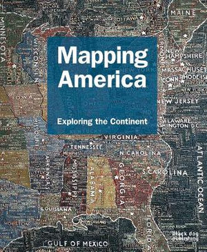
? Beautifully illustrated survey of North America?s cartographic landscape Following on from Mapping New York, Mapping London, and Mapping England, Mapping America: Exploring the Continent takes a similar approach in its presentation, thematically arranging a vivid collection of historic, demographic, cultural and artistic maps to aid the reader on their journey. Featuring four centuries of maps that depict the changing landscape of North America, Mapping America charts the continent through numerous landmark events and uprisings, including the Louisiana Purchase, the ?opening? of the frontier, the Civil War, and more recent concerns, such as the environment and national security. From early maps depicting the country?s colonial beginnings, through to contemporary maps depicting America today, the book presents the reader with a multi-faceted view of the North American physical and cultural landscape; from maps showing the electoral routes of Presidential campaigns, to the diminishing native communities shown in census maps, to maps charting the country?s health statistics. Alongside the historic, geographic, and political, the book also pays particular attention to the artistic and imaginative, documenting America?s rich and descriptive literary and artistic past. Jack Kerouac?s journey taken from his seminal tale in On the Road is documented in a hand-drawn map, whilst numerous artists known for their interest in cartography are featured, from the representational to the abstract, including Paula Scher with The United States and Daniel Medina with Map Cube World. Not just for cartography enthusiasts, Mapping America: Exploring the Continent appeals to the general reader, as well as specialists in the areas of geography, art, architecture and design. The publication includes: - Vincenzo Maria Coronelli?s America Settentrionale Colle Nuove Scoperte Sin All Anno, 1688. - Jean Palairet?s Carte De L? Amerique Septentrionale, 1755. - DG & AJ Johnson?s New Map Of The Union, 1857, which includes sites of gold discovery and various nautical vignettes. - Ron Arad?s bookshelf sculpture ?Oh, the farmer & the cowman should be friends?. - Lordy Rodriguez?s 55 States, which abstractly reinvents, skews and expands the continent. - Kathy Prendergast?s Lost, an ?emotional? map of North America. - Cross-continental route maps for both historical and contemporary transport networks. - NASA?s hauntingly disconnected images of a light-speckled US at night. - Myriad literary maps of the US, encompassing a national overviews of Black Writers for Young America, pictorial charts of historically notable American writers, A Map of Sinclair Lewis? United States as it appears in his novels, and a map tracking The Adventures of Huckleberry Finn. AUTHOR: Fritz Kessler is a Professor of Geography at Frostburg State University, he is editor of Cartographic Perspectives Journal and contributed to various books on the subject. Frank Jacobs is a journalist and a writer who hosts the blog Strange Maps, and was the author of the book Strange Maps: An Atlas of Cartographic Curiosities. SELLING POINTS Features an array of maps that document its development, from early engravings, to the latest satellite technology. Four centuries of maps that portray the rich story of North America?s progression from colonial beginnings, through to the division of the states and up to the current day. Includes historical, geographic and political maps alongside artistic and imaginative maps providing a complete overview of the rich social and cultural history of North America. Beautifully presented, with hundreds of maps ranging from the historically accurate, the imaginative, informative and entertaining, Mapping America is accessible to all, with a general appeal and a great gift for Christmas. ILLUSTRATIONS 320 colour & b/w illustrations
Industry Reviews
"Appealing to cartographers, historians and art-enthusiasts, Mapping America exposes a unique view of American past, present and future." City Arts NYC
"The sheer range and diversity of the maps contained in this book make summing it up an impossible task. The selection resembles the colourful, sometimes strange and contradictory melting pot of today's America [...] will appeal to map addicts and general readers alike." The Geographical Journal


![Hidden Figures : The Untold Story of the African American Women Who Helped Win the Space Race [Film Tie-In Edition] - Margot Lee Shetterly](https://www.booktopia.com.au/covers/200/9780008201326/null/hidden-figures.jpg)